Paper Title: Geospatial-based AHP approach for rainwater harvesting sites in semi-arid areas: a case study of Wadi Abu Ghraibat
Authors: Hisham M. Jawad Al Sharaa, Nadia A. Aziz, Israa Hatem
Corresponding Author: Nadia A. Aziz (nadia.a.aziz@uotechnology.edu.iq)/ Iraq
Abstract
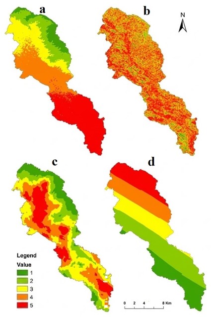
Rainwater harvesting is becoming an important method of water management in semi-arid areas characterized by seasonal and perennial water scarcity. The investigation demonstrates a novel Analytic Hierarchy Process technique based on geospatial methods, applied to assess site suitability for rainwater harvesting in the semi-arid Wadi Abu Ghraibat area. Elevation, slope, precipitation, and drainage density were the four variables considered important in this respect. Each of these criteria was processed using both GIS and remote sensing data and weighted by the Analytic Hierarchy Process, which assigned 24% to elevation, 10% to slope, 22% to precipitation, and 44% to drainage density, with a consistency ratio of 0.06, which was acceptable. Therefore, the suitability map can be considered the area’s most suitable for implementing rainwater harvesting practices. Although it is limited to water-stressed environments, interesting findings on water resource management lessons emerge. GIS-based integrated approach combining MCDA with GIS for sustainable water management in drought-prone regions.